
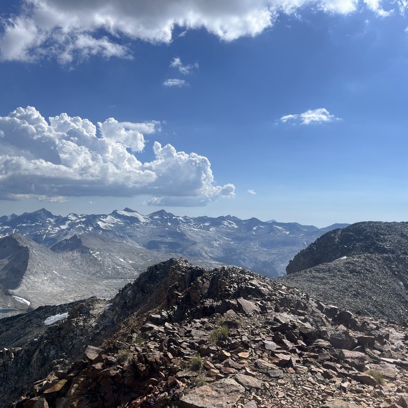
Yosemite High Route
Cross Yosemite’s remote southeast corner on a 40-mile high route with three days off-trail, two off-trail passes and close-up views of Mt. Lyell and the Lyell Glacier.
Yosemite National Park
$2,645
Off-Trail Across Yosemite’s Cathedral Range
The Yosemite High Route is a 40-mile point-to-point trek deep into Yosemite’s wilderness, over off-trail passes and past the remnants of the once great glaciers that carved Yosemite Valley. Three days of off-trail travel open up some of the most remote and stunning alpine terrain in the Sierra, places that see only a handful of hikers each year.
This is one of the most challenging routes TSX offers. The terrain over six days will test even experienced backpackers, but you’ll finish feeling accomplished and inspired, counted among the lucky few who have seen these wild places.
What’s included
- Transportation between Fresno/Clovis, CA area meeting point and trailhead
- Guided trek over 6 days to Yosemite National Park and Mt. Lyell & Cathedral Range
- All meals and snacks while in the backcountry
- Backpack, tent, sleeping bag and pad if needed
- Personalized pack-check prior to departure
- Group gear and equipment
- Flexible cancellation policy
- Inspiration for a lifetime
What’s not included
- Meals in the front-country
- Lodging in the front-country, pre- or post-trek
How it works
A $500 deposit per person is required with balance due 60 days prior to the event. Typical group size of 7, including one guide. Maximum group size of 12, including two guides. This route is among the most challenging TSX offers and is best suited to past TSX participants and experienced backpackers who are comfortable on steep, off-trail terrain. An additional 5% charge will be applied when your reservation is made to offset new fees mandated by the National Park Service. Private, family and modified itinerary trips available through TSX Pods. Book with confidence! Review our flexible cancellation policy.
The Route
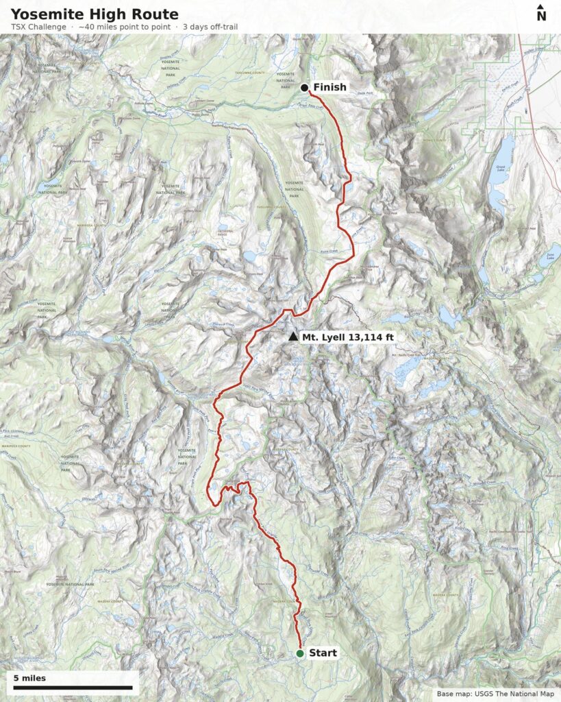
We’re trying something a little different with this one. Instead of a day-by-day itinerary, we’re sharing the route itself. This 40-mile point-to-point trek starts south of the park and finishes on Yosemite’s Tioga Road, crossing the remote southeast corner of Yosemite along the way.
The highlight is three days of off-trail travel over the Cathedral Range. We’ll cross two off-trail passes and travel right past Mt. Lyell, the highest point in the park, and the Lyell Glacier. These off-trail days are demanding, but the reward is seeing pristine corners of Yosemite that only a handful of hikers reach each year.
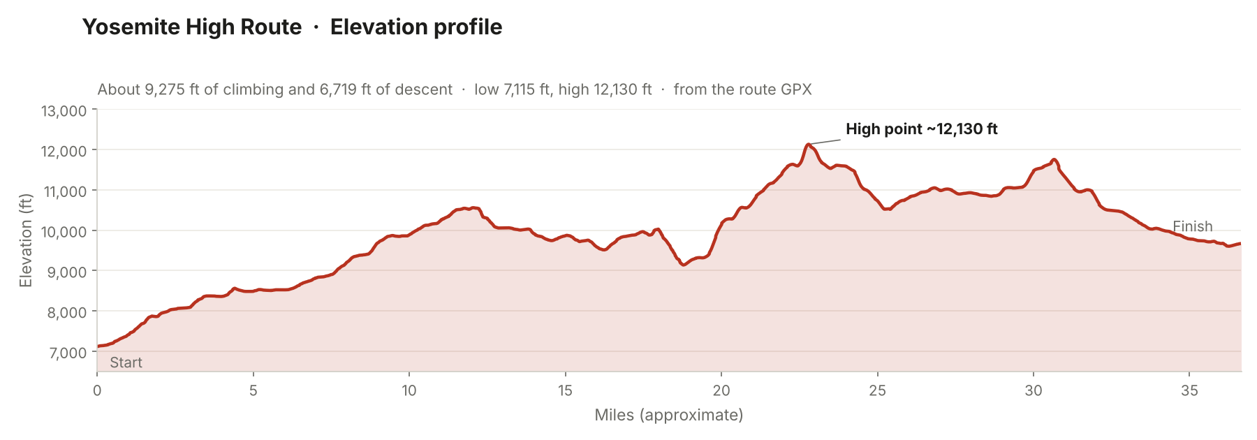
Our camps aren’t fixed. We’ll choose them each day based on the group’s pace, the terrain and conditions. Please note mileage is not indicative of difficulty! The route map and elevation profile show the full line, from about 7,100 feet at the start to a high point around 12,100 feet, with roughly 9,300 feet of total climbing.
Logistics
Departure and pickup locations
On the day of departure, TSX will coordinate transportation between Central California (Fresno/Clovis area) and our starting trailhead.
- Central California Pick-up Point: Clovis Cole Best Western, Clovis, CA – 5.00am
- Starting trailhead (if local and prefer driving; details to be provided)
The specific departure time will be confirmed on a trek by trek basis. The Fresno/Clovis area is a 3 hour car drive from the Bay Area, and roughly 4 hours from Southern California. Meals are not provided when in transit, however, we will stop for food and to refuel before reaching the trailhead. Our goal is to make it to the trailhead in time to begin a late morning hike.
Pre- and post-trek accommodations (Out of State Guests)
For guest traveling in from out of state, we suggest flying into Fresno, CA the evening before departure and staying at the Best Western Clovis Cole, in historic downtown Clovis or Hampton Inn and Suites Clovis. Both are about a 10 minute cab/Uber ride from the airport. We can pick you up at the hotel on the morning of departure. If you plan on staying somewhere else, please let us know where you end up, and we’ll do our best to accommodate.
At the trailhead
Bring your personal items and a positive attitude! All group gear and food will be provided on the trail. Any major personal gear you’ve indicated you’d like us to provide (sleeping bag, tents etc.) will be waiting for you at the trailhead.
Returning home
This is a point-to-point route that finishes on Yosemite’s Tioga Road. TSX will shuttle the group back to the Fresno/Clovis area. Exit and return times will be confirmed closer to departure; please don’t book same-day flights home until then. Staying one additional night in the Clovis, Fresno or Shaver Lake area is a popular option.
WHAT YOU’LL NEED
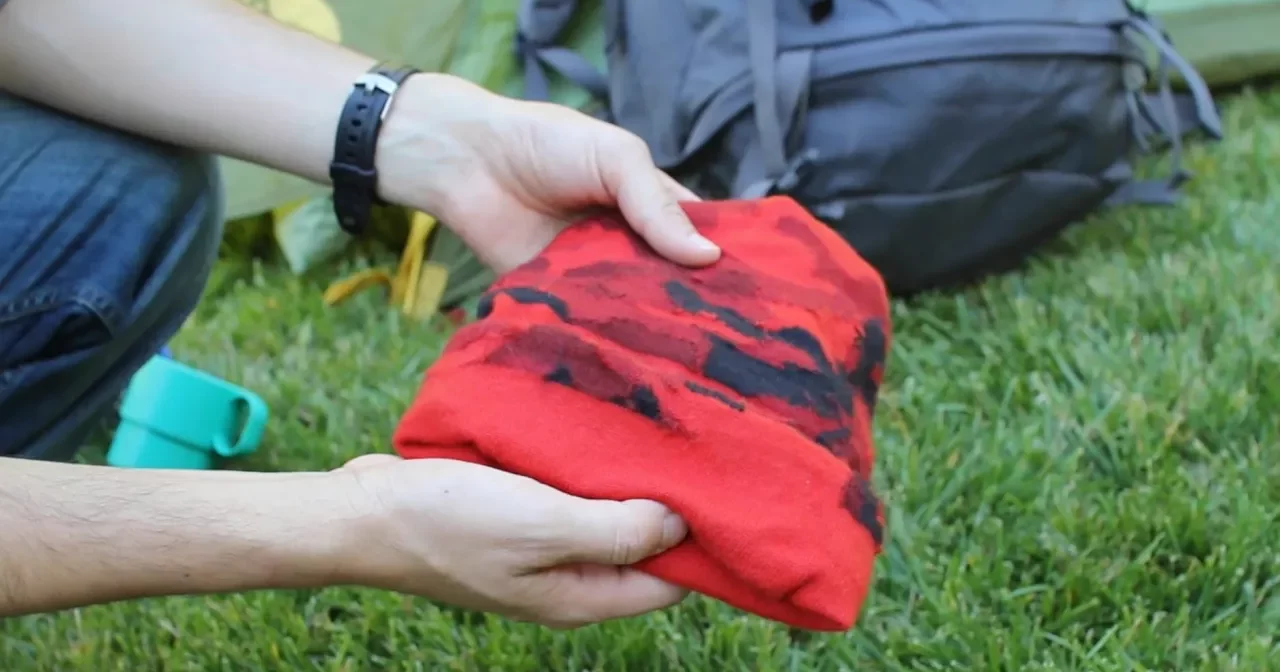
Don’t own a backpack, tent or sleeping bag? We provide all major gear for those who request it at no additional charge. We also take care of all group items like stoves, food, water filters, first aid and more. Your guides will do the cooking and dishes. Just show up with your personal items ready to hike!
Related treks
-
9 days | 50 Miles | September
View trek dates
Select options This product has multiple variants. The options may be chosen on the product page -

6 days | 50 Miles | Aug, Sept
View trek dates
Select Date Select options This product has multiple variants. The options may be chosen on the product page -

5 days | 26 Miles | MAR, APR, MAY, SEPT, OCT, NOV
View trek dates
Select options This product has multiple variants. The options may be chosen on the product page -
14 days | 60 Miles | August
View trek dates
Select Date Select options This product has multiple variants. The options may be chosen on the product page
Reviews
There are no reviews yet.